How AI can unearth archaeological sites
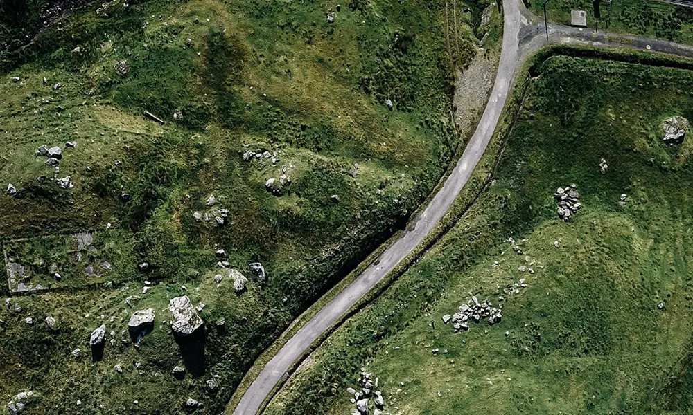
When you think of archaeology, trowels, excavations and carefully brushing dust off thousand-year-old artefacts might come to mind. But archaeologists are no strangers to advanced technology. Following a long tradition of using aerial photography to detect ancient human imprints left on landscapes, archaeologists have been using LiDAR extensively to map lumps and bumps in the terrain since the early 2000s.
These imprints, formed over artificially sculpted and manoeuvred rocks and soil, are known as ‘earthworks’. LiDAR scanners mounted on small aircraft can detect them from above by bouncing laser light off a surface and detecting the signal that returns – similar to radar, but much more precise. The result is a 3D ‘point cloud’ that shows the topography of the terrain, usually to a precision of between half a metre to a metre.
Modern-day LiDAR scanners can even see through dense forest, enabling archaeologists to map areas of up to tens of square kilometres in under an hour. By contrast, surveying the same area traditionally – on foot – can take years. However, although this approach has given a huge boost to collecting data, archaeologists still had to manually sort through the data to classify archaeological sites.
Bringing in deep learning
Enter Iris – an archaeology master’s student at the University of Southampton, who was fascinated with airborne LiDAR. She was also convinced that there was a better way than painstakingly combing through datasets. However, there was a problem. “Automated site detection had never successfully been done, and some experts said it could never be done at all,” says Iris.
But she wasn’t going to be put off so easily. She discovered a software tool used by geographers to detect landslides from satellite imagery. By applying it to LiDAR data, she was able to detect 20% of known burial mounds in a dataset. But Iris wanted better results and knew she could go no further without more advanced software.
While she knew machine learning tools would be perfect for the job, at the time, none existed. This left her with one choice: building it herself – but she had no experience in coding or with machine learning. A three-month coding course later, courtesy of the Dutch government, and Iris returned to Southampton with funding for a PhD to develop her deep learning analysis tool.
Uncovering lost sites
The acid test of the AI she built was on a dataset of LiDAR imagery from the Isle of Arran. On Arran (and throughout Scotland), archaeologists believe that tens of thousands of historic sites are waiting to be discovered. However, a hilly, irregular landscape make them difficult to detect. Archaeologists from Historic Environment Scotland had assessed this dataset and identified potential sites of interest, so her tool needed to be able to find these to prove its worth. But when Iris applied her AI to the LiDAR data, as well as finding sites that the archaeologists had detected, it detected 200 false positives. Disappointed, Iris asked the experts to look at the mistakes to help her understand how to improve its accuracy.
It turned out that rather than mistakes, there were actually 120 new site locations that had been missed by the experts. In fact, after reviewing their GPS tracking data from a field visit, they had missed one even while standing right on top of it. For the other 80 false positives, the experts explained that other data, including aerial photography and geological maps, would be needed to draw a conclusion.
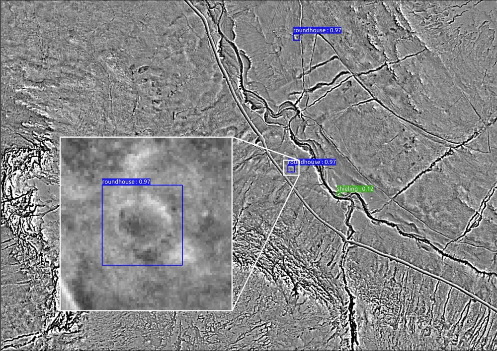
The site of a roundhouse on the Isle of Arran, detected by Iris' software.
The technology clearly had potential. Iris knew that to realise this at the speed she wanted, she would need to spin out a company. She joined Southampton’s accelerator, hired the best PhD student from the lab, and ArchAI was born. In the few years since, the company has developed a prototype able to detect all kinds of archaeological sites, including, among other things, hillforts, medieval villages, quarries, cairns, and roundhouses.
The way it does this is using computer vision models called deep convolutional neural networks. Like all machine learning models, these neural networks are trained on data – in this case, previously detected and labelled archaeological sites from different types of Earth observation data. Along with LiDAR data, ArchAI’s models can also process other types of data such as satellite photos and historical maps. In satellite photos, patterns in crops and grass indicate buried historical sites – the presence of features such as walls and ditches. These patterns become more visible in dry conditions. Historical maps are also a useful input, as they provide the historic locations of woodland, ponds and hedges.
Planting trees, studying biodiversity and preventing historical site damage
Now, ArchAI has a number of high-profile customers and varied use cases. In work for the Forestry Commission, ArchAI’s software analysed LiDAR data to spot ridge and furrow earthworks left behind by medieval ploughing, helping them to decide where new trees can be planted, and where these ancient earthworks should be preserved.
Meanwhile, in a project for the National Trust, ArchAI analysed maps from the early 1900s to compare historic locations of orchards to modern locations. As a result, the National Trust demonstrated that the area covered by orchards in England and Wales has fallen by over half since the turn of the 20th century. The organisation has since made a case to replant them to recoup the biodiversity losses – especially of insects.
However, ArchAI is primarily homing in on the construction sector. According to the company, identifying archaeological sites at the earliest planning stages helps to avoid spiralling costs for developers, along with protecting historic sites from unnecessary disturbances and excavations. In one example at a recent 15-home development in a village near Hartlepool, an ancient burial site was discovered after construction work had begun. The archaeological fees skyrocketed from £20,000 to almost £400,000, while work on the site was paused for over a year.
“Construction projects have a big impact on their environment [so] it's a legal requirement to assess potential damages before planning permission is granted,” says Iris. “Our solution significantly reduces the time and cost of archaeological assessments.” These assessments currently take between six and 24 months and cost up to 5% of the overall construction project budget. With this selling point amplified even further for large-scale infrastructure projects, Iris says their instant assessment can be used at the earliest design phases of new routes.
While ArchAI has enjoyed steady organic growth during the initial technology development phase, there is more to do before the full roll-out of the tool. “Initial tests on satellite imagery have shown the results are variable, and depend on crops, the season and the weather,” says Iris. “We need to further develop our technology to account for this and create a higher volume of training data.” Once complete, Iris hopes that ArchAI will be the leader in landscape heritage detection – helping to uncover many of the traces buried underground until now.
Keep up-to-date with Ingenia for free
SubscribeRelated content
Arts & culture

How to maximise loudspeaker quality
Ingenia asked Dr Jack Oclee-Brown, Head of Acoustics at KEF Audio, to outline the considerations that audio engineers need to make when developing high-quality speakers.

Engineering personality into robots
Robots that have personalities and interact with humans have long been the preserve of sci-fi films, although usually portrayed by actors in costumes or CGI. However, as the field of robotics develops, these robots are becoming real. Find out about the scene-stealing, real-life Star Wars droids.

Design-led innovation and sustainability
The Stavros Niarchos Foundation Cultural Center, the new home of the Greek National Opera and the Greek National Library, boasts an innovative, slender canopy that is the largest and most highly engineered ferrocement structure in the world.
The technology behind ‘The Tempest'
William Shakespeare’s The Tempest is a fantastical play that features illusion and otherworldly beings. Discover how cutting-edge technology, such as motion capture and sensors, has brought the magic and spectacle to life on stage.
Other content from Ingenia
Quick read

- Environment & sustainability
- Opinion
A young engineer’s perspective on the good, the bad and the ugly of COP27

- Environment & sustainability
- Issue 95
How do we pay for net zero technologies?
Quick read

- Transport
- Mechanical
- How I got here
Electrifying trains and STEMAZING outreach

- Civil & structural
- Environment & sustainability
- Issue 95